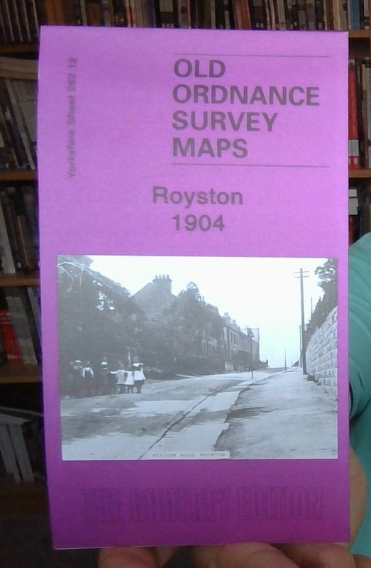
This detailed map covers the village - or small town - of Royston, about three miles north of Barnsley. Most of the village is covered, with coverage extending from the Railway Hotel eastward to Whincover and Royston Bridge, and from the GCR station southward to the Old Ring of Bells pub. Features include St John's church, Chantry House, old Grammar School, stretches of the Barnsley Canal, Ship Inn (original site at Whincover), short stretch of Midland Railway and Monckton Main Colliery Railway, GCR 'Barnsley Coal Railway Extension' with Notton for Royston station, Manor House, Applehaigh, Wellfield House etc. On the reverse we include directories of Royston for both 1889 and 1936.
| Type | Street Map/Directory |
| Publication Name | MAP OF Royston 1904 |
| Author | Alan Godfrey |
| Publisher | Alan Godfrey Maps |
| Topic | Local History |
| Subject | History |
| Country Of Origin | United Kingdom |
| ISBN | 9781847842282 |
This detailed map covers the village – or small town – of Royston, about three miles north of Barnsley. Most of the village is covered, with coverage extending from the Railway Hotel eastward to Whincover and Royston Bridge, and from the GCR station southward to the Old Ring of Bells pub. Features include St John’s church, Chantry House, old Grammar School, stretches of the Barnsley Canal, Ship Inn (original site at Whincover), short stretch of Midland Railway and Monckton Main Colliery Railway, GCR ‘Barnsley Coal Railway Extension’ with Notton for Royston station, Manor House, Applehaigh, Wellfield House etc. On the reverse we include directories of Royston for both 1889 and 1936.