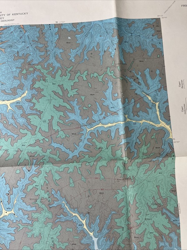

Vintage 1967 United States Geological Survey Map Geologic Map of the Frogue Quadrangle Burkesville Cumberland Co. Kentucky KY Dale Hollow Lake, Chestnut Grove, Cumberland River, Fannys Creek University of Kentucky Large, Colorful 31” x 33.75” (Corner is clipped as pictured)
| Publisher | US Geological Survey |
| City | Burkesville |
| Subject | Maps |
| Publication Year | 1967 |
| Type | Geological Map |
| Language | American English |
| Item Height | 31 in |
| Country | United States |
| Author | Richard Q. Lewis, Sr. |
| Region | Kentucky |
| Map Scale | 1:24,000 |
| Country Of Origin | United States |
| Item Width | 33.75 in |
Vintage 1967 United States Geological Survey Map Geologic Map of the Frogue Quadrangle Burkesville Cumberland Co. Kentucky KY Dale Hollow Lake, Chestnut Grove, Cumberland River, Fannys Creek University of Kentucky Large, Colorful 31” x 33.75” (Corner is clipped as pictured)

![Becker Professional Education Financial CPA Exam Review V 4.2 [2022] VG COND](/images/NG4AAeSwC7hqKgf5/Becker-Professional-Education-Financial.webp)